
Learn More
Environmental Process
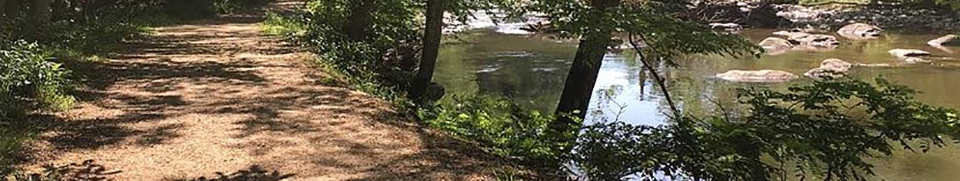
As part of the Route 7 Corridor Improvements Project, about 1,200 linear feet of Colvin Run will be relocated slightly to the south to accommodate additional lanes along Route 7 and a longer and taller bridge over Difficult Run.
PERMITS REQUIRED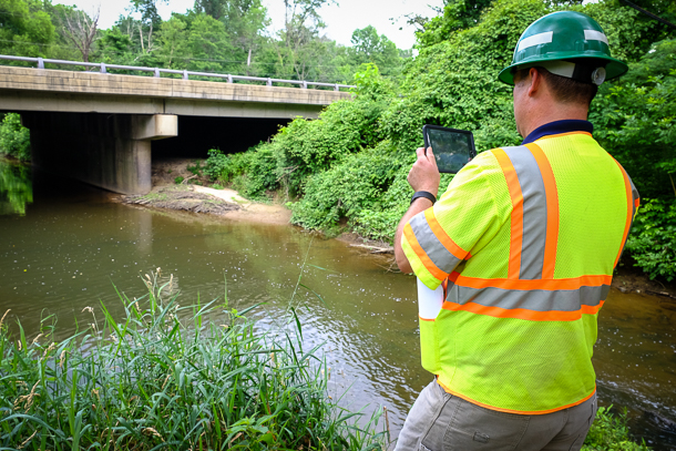
As part of this project, permits are required from the United States Army Corps of Engineers (USACE), the Virginia Department of Environmental Quality (VDEQ), and the Virginia Marine Resources Commission (VMRC). All Clean Water Act Permits will be acquired prior to any work in Wetland and or Waters of the U.S. (WOUS), which include Colvin Run and Difficult Run.
ENVIRONMENTAL COORDINATION
During the project's early development, VDOT coordinated with the USACE, VDEQ, and Environmental Protection Agency (EPA) on the conceptual designs to obtain a preliminary Least Environmentally Damaging Practical Alternative (LEDPA) determination. The LEDPA is the only alternative the USACE can permit under their regulations (Clean Water Act Section 404(b)(1) Guidelines (40CFR230)). Click here for more details on the timeline.
CONSTRAINTS AND DESIGN CONSIDERATIONS
Floodplain
Colvin Run exists within a mapped Federal Emergency Management Agency (FEMA) floodplain. By VDOT policy, the design (of the retaining wall, stream relocation, bridge, etc.) cannot cause for a rise in the 100-year floodplain elevation. This could affect flood insurance rates for adjacent impacted properties. If there were no alternative to avoid it, VDOT would need to obtain approvals from FEMA, and as floodplain manager for this project, Fairfax County would also need to approve an alternative causing a change in the 100-year floodplain elevation.
Parkland, Historic Properties, and Trails
On the north and south sides of Route 7 are Difficult Run Stream Valley Park and Colvin Run Mill Park, both owned by Fairfax County Park Authority, and are protected resources under Section 4(f) of the USDOT Act. Additionally, the Colvin Mill Historic District and Colvin Mill are historic properties, protected by Section 106 of the National Historic Preservation Act.
The Gerry Connolly Cross County Trail is also being relocated in portions as Route 7 is widened. The trail and its footprint must also be considered in terms of impacts to sensitive environmental resources. The trail was originally proposed to be construction of wood chips as it serves pedestrians and equestrians.
Utilities
Fairfax Water owns and operates a 54-inch high-pressured water line (a public water supply intake for Fairfax County) parallel to the proposed relocated stream. There is little room available between the proposed retaining wall (on the approach to Route 7 over Difficult Run) and the water line to create a meandering stream. If a meandering stream were constructed, the 54” water main would need to be relocated, estimated to cost more than $2 million and add at least one year to the overall schedule, and would cause additional impacts to adjacent wetlands.
A 42-inch sanitary sewer line, owned in part by DC Water and in part by the Town of Vienna, is situated under the proposed Route 7 bridge over Difficult Run. Access must be maintained to the existing manholes and pump station. The current design (versus a meandering stream) does not require relocation of this utility to avoid additional cost, schedule impact, and impacts to adjacent wetlands.
Please see the Environmental FAQ page for additional information.
